India: Map/Geography

The Republic of India is located in South Asia. It is the seventh largest country in the world
and covers an area of 3.3 million square kilometers. Because of its size, India is less a country
than a continent. By population it is the second most populous country in the world and has a
population of about 1 billion people. India shares borders with Pakistan, China, Myanmar, Bangladesh,
Nepal, Bhutan and Afghanistan and has a coastline of 7,600 kilometres.
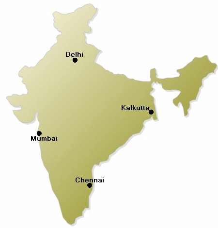
The capital city of India is New Delhi, which is located in the north of the country. New Delhi is
part of Delhi, which has a population of about 14 million residents. Other huge cities are Mumbai
(the former Bombay) or Chennai (the former Madras) or Kolkata (the former Calcutta).
During the middle of the second millenium, several European countries (including the Portuguese,
French and English) colonised the Indian subcontinent. After 1857 most of the country was ruled
by the British Empire. India gained independence from the British rule in 1947. After that it became
the worlds largest democratic republic.
The major religion in India is the Hinduism, followed by the Islam at second place. Other widespread
religions are Christianity, Buddhism, Sikhism and Jainism. Major languages in India are Hindi, English
and 17 other official languages.

